
Landslide-prone Nepal tests AI-powered warning system
By Anup OJHA
Kathmandu (AFP) Aug 1, 2025
Every morning, Nepali primary school teacher Bina Tamang steps outside her home and checks the rain gauge, part of an early warning system in one of the world’s most landslide-prone regions.
Tamang contributes to an AI-powered early warning system that uses rainfall and ground movement data, local observations and satellite imagery to predict landslides up to weeks in advance, according to its developers at the University of Melbourne.
From her home in Kimtang village in the hills of northwest Nepal, 29-year-old Tamang sends photos of the water level to experts in the capital Kathmandu, a five-hour drive to the south.
“Our village is located in difficult terrain, and landslides are frequent here, like many villages in Nepal,” Tamang told AFP.
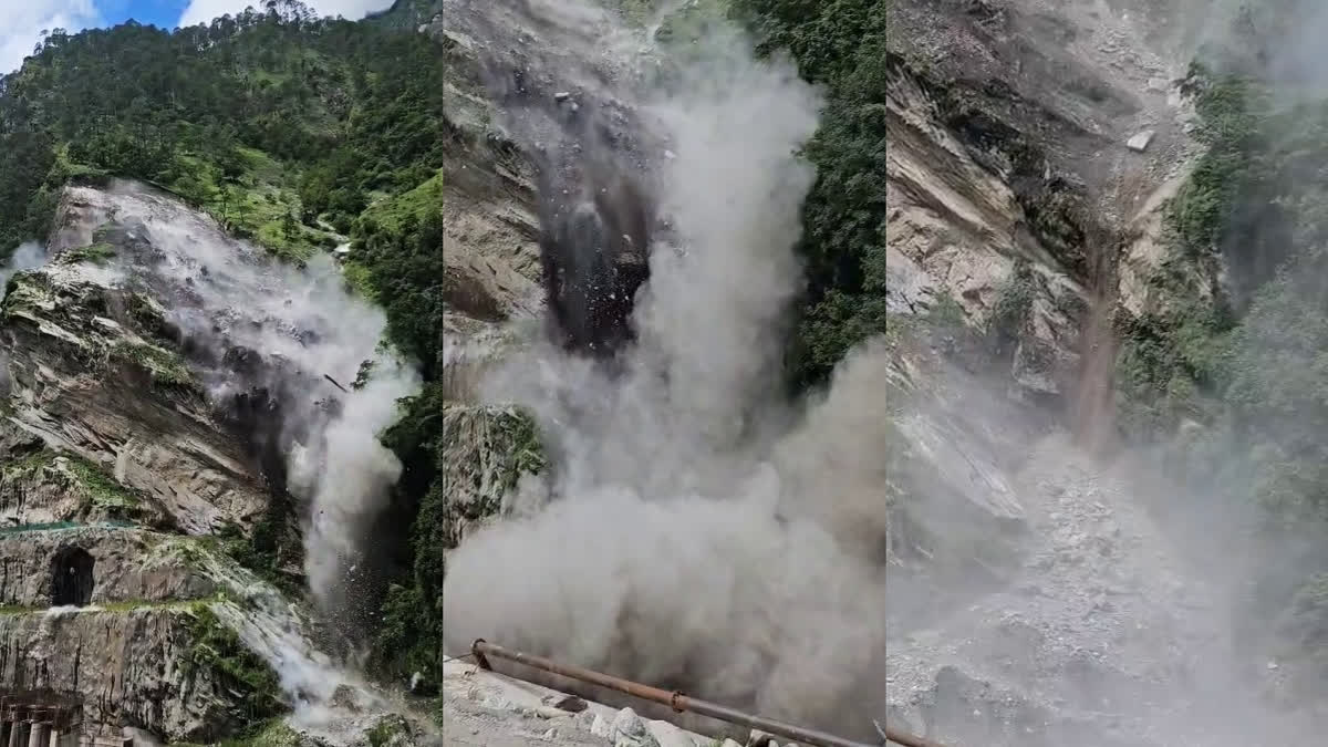
Every year during the monsoon season, floods and landslides wreak havoc across South Asia, killing hundreds of people.
Nepal is especially vulnerable due to unstable geology, shifting rainfall patterns and poorly planned development.
As a mountainous country, it is already “highly prone” to landslides, said Rajendra Sharma, an early warning expert at the National Disaster Risk Reduction and Management Authority.
“And climate change is fuelling them further. Shifting rainfall patterns, rain instead of snowfall in high altitudes and even increase in wildfires are triggering soil erosion,” Sharma told AFP.
– Saving lives –
Landslides killed more than 300 people last year and were responsible for 70 percent of monsoon-linked deaths, government data shows.
Tamang knows the risks first hand.
When she was just five years old, her family and dozens of others relocated after soil erosion threatened their village homes.
They moved about a kilometre (0.6 miles) uphill, but a strong 2015 earthquake left the area even more unstable, prompting many families to flee again.
“The villagers here have lived in fear,” Tamang said.
“But I am hopeful that this new early warning system will help save lives.”
The landslide forecasting platform was developed by Australian professor Antoinette Tordesillas with partners in Nepal, Britain and Italy.
Its name, SAFE-RISCCS, is an acronym of a complex title — Spatiotemporal Analytics, Forecasting and Estimation of Risks from Climate Change Systems.
“This is a low-cost but high-impact solution, one that’s both scientifically informed and locally owned,” Tordesillas told AFP.
Professor Basanta Adhikari from Nepal’s Tribhuvan University, who is involved in the project, said that similar systems were already in use in several other countries, including the United States and China.
“We are monitoring landslide-prone areas using the same principles that have been applied abroad, adapted to Nepal’s terrain,” he told AFP.
“If the system performs well during this monsoon season, we can be confident that it will work in Nepal as well, despite the country’s complex Himalayan terrain.”
In Nepal, it is being piloted in two high-risk areas: Kimtang in Nuwakot district and Jyotinagar in Dhading district.
– Early warnings –
Tamang’s data is handled by technical advisers like Sanjaya Devkota, who compares it against a threshol
Read More